We Provide Geospatial Data Solutions for Operations, Compliance, Development, and Exploration
Our Mission
Since 1993, it has been our mission to support safe and responsible projects around the world by applying our expertise in ways that offer smart solutions to real world challenges.
We leverage the best in satellite technology to deliver unique geospatial data that helps engineers and geologists shorten project timelines, promote safety, and drive efficiency in each phase of a project.
Our Expertise
Remote Sensing
We are experts in satellite imagery, working with a range of high-capability satellites. Our technology is tailored to each type of satellite data.
Geophysical Processing
Our experts have decades of experience in topographic surveying, alteration mapping, and more.
Deep Learning Technology
Our proprietary software is designed and tested for optical satellite data, including mono, stereo and multispectral satellite data.
Our Advantage
Safe and efficient access to large or remote project sites, with global consistency.
No permits or ground access required.
Our Projects
We support safe and responsible projects around the world. Since 1993, we have delivered over 3000 projects in more than 75 countries.
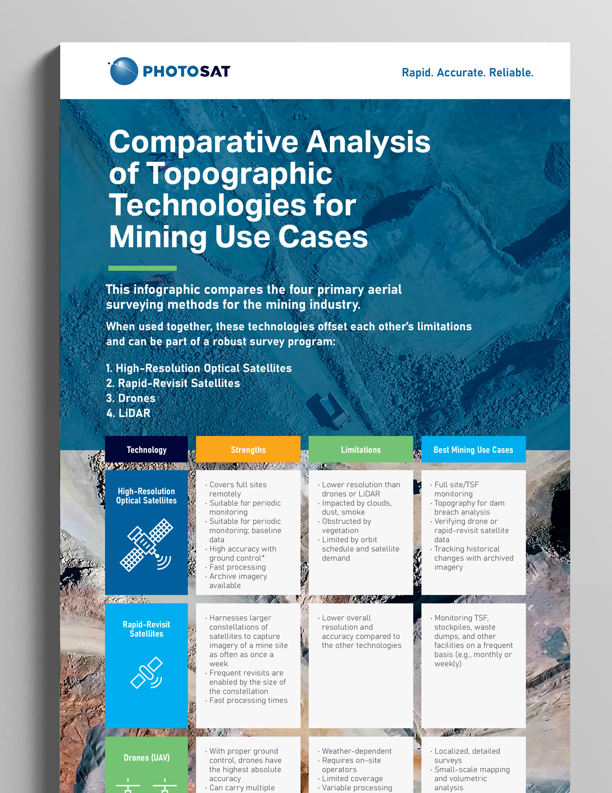
Unlock Smarter Site Monitoring Get Your Complete Resource Kit Today
Gain a deeper understanding of site monitoring technologies—satellites, drones, and LiDAR—with our expert-curated content bundle designed for mining professionals.
Infographic
At-a-glance comparison of resolution, accuracy, cost, and deployment timelines across technologies.