Geospatial Data for Exploration & Geology

Regional Topography

User-ready topography for exploration planning
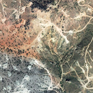
When geologists are planning new exploration programs, it is crucial to have access to reliable topography of the area. But when these areas are remote or large, getting reliable topography can be difficult, potentially delaying a project at the start.

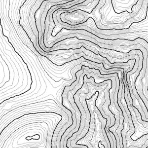
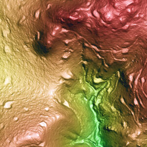
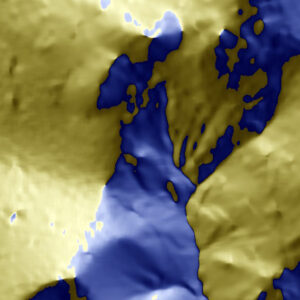
PhotoSat’s Regional Topography package equips exploration professionals with reliable topographic data, without the need for ground control or site access.
Contours
Slope Direction Image
Contours
Slope Direction Image
Key applications:
  • 3D modelling
  • Exploration program planning
  • Geological targeting
  • Logistical coordination
Elevation grid formats:
File Format(s): ASCII, CSV, DWG, DXF, ECW, ERS, LAS, TIF, and XML.

Thinned Grid formats are available to reduce file size for projects over low-grade slopes.
Technical Specifications:
Type
3D terrain surface with ground features (DEM/DSM)
Vertical Accuracy (with control)
~1 – 2 m RMSE More Info
Satellite Specifications for Topographic Maps
Some specifications for topographic mapping deliverables depend on the satellite used to acquire the imagery.
Satellite Orthophoto Ground Resolution (Pixel Size) Orthophoto Colour Elevation Grid Spacing (Ground Sample Distance)
SPOT 6 1.5 m Colour 3 m
SPOT 7 2 m Colour 3 m
ALOS PRISM 2.5 m Colour 3 m
GeoEye 0.5 m Colour 3 m
Relative Accuracy
~3 m over 10 km
Elevation Grid Resolution (GSD)
3 m or custom
Vegetation Removal
No
Available from Archive Imagery
Yes
Satellites Source(s)
Spot 6; Spot 7
Area of Interest
Custom
Coordinate System
Any, including custom mine grids

Deliverables

The Regional Topography package includes these standard deliverables.
Standard Deliverables Optional Deliverables

Exploration Surveying

Start your project with engineering-grade survey data, that can be used in design, planning, and more.

Our technical team is ready to work with you