Surveying for Mining & Development

Archive Surveying

Analysis-ready data for forensic engineering and legacy asset management
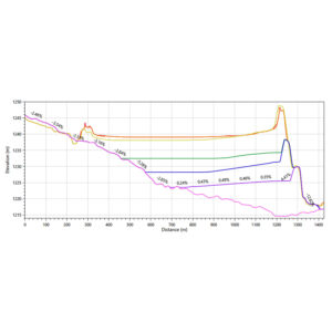
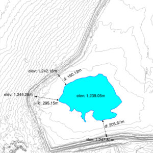
More than five decades of archive satellite imagery exists. For years where the imagery exists, it may be possible to produce elevation surveys (DEM) from archive satellite imagery.

PhotoSat’s Archive Surveying helps engineers understand the operational and structural history of a site, either by filling in gaps in the survey record or verifying existing survey data.
1973 Orthophoto from Keyhole Satellite
2010 Orthophoto from WorldView-2
1973 Orthophoto from Keyhole Satellite
2010 Orthophoto from WorldView-2
Key applications:
  • Legacy tailings facility management
  • Forensic engineering
  • Production of pre-construction original ground surface
  • Mine closure and compliance
Elevation grid formats:
File Format(s): ASCII, CSV, DWG, DXF, ECW, ERS, LAS, TIF, and XML.

Thinned Grid formats are available to reduce file size for projects over low-grade slopes.
Technical Specifications:
Type
Bare ground surface (DEM) or Orthophoto
Vertical Accuracy (with control)
Based on satellite specifications More Info
Satellite Specifications for Elevation Surveys
Some specifications for survey deliverables depend on the satellite used to acquire the imagery.
Satellite Expected Vertical Accuracy Orthophoto Ground Resolution (Pixel Size) Orthophoto Colour Elevation Grid Spacing (Ground Sample Distance)
WV1 10 – 15 cm RMSE (with ground control) 50 cm Greyscale, with colourization options available 1 m or 50 cm
WV2 10 – 15 cm RMSE (with ground control) 50 cm Colour 1 m or 50 cm
WV3 10 – 15 cm RMSE (with ground control) 50 cm or 30 cm Colour 1 m, 50 cm, 30 cm, or 15 cm (resampled)
Pleiades 1A 20 – 30 cm RMSE (with ground control) 50 cm Colour 50 cm
Pleiades 1B 20 – 30 cm RMSE (with ground control) 50 cm Colour 50 cm
Keyhole -- 0.61 m to 1.2 m Greyscale 0.61 m to 1.2 m
Relative Accuracy
Based on satellite specifications More Info
Satellite Specifications for Elevation Surveys
Some specifications for survey deliverables depend on the satellite used to acquire the imagery.
Satellite Expected Vertical Accuracy Orthophoto Ground Resolution (Pixel Size) Orthophoto Colour Elevation Grid Spacing (Ground Sample Distance)
WV1 10 – 15 cm RMSE (with ground control) 1 m or 50 cm Greyscale, with colourization options available 1 m or 50 cm
WV2 10 – 15 cm RMSE (with ground control) 1 m or 50 cm Colour 1 m or 50 cm
WV3 10 – 15 cm RMSE (with ground control) 1 m, 50 cm, or 30 cm Colour 1 m, 50 cm, 30 cm, or 15 cm (resampled)
Pleiades 1A 20 – 30 cm RMSE (with ground control) 50 cm Colour 50 cm
Pleiades 1B 20 – 30 cm RMSE (with ground control) 50 cm Colour 50 cm
Keyhole -- 0.61 m to 1.2 m Greyscale 0.61 m to 1.2 m
Ground Resolution (GSD)
Based on satellite specifications More Info
Satellite Specifications for Elevation Surveys
Some specifications for survey deliverables depend on the satellite used to acquire the imagery.
Satellite Expected Vertical Accuracy Orthophoto Ground Resolution (Pixel Size) Orthophoto Colour Elevation Grid Spacing (Ground Sample Distance)
WV1 10 – 15 cm RMSE (with ground control) 1 m or 50 cm Greyscale, with colourization options available 1 m or 50 cm
WV2 10 – 15 cm RMSE (with ground control) 1 m or 50 cm Colour 1 m or 50 cm
WV3 10 – 15 cm RMSE (with ground control) 1 m, 50 cm, or 30 cm Colour 1 m, 50 cm, 30 cm, or 15 cm (resampled)
Pleiades 1A 20 – 30 cm RMSE (with ground control) 50 cm Colour 50 cm
Pleiades 1B 20 – 30 cm RMSE (with ground control) 50 cm Colour 50 cm
Keyhole -- 0.61 m to 1.2 m Greyscale 0.61 m to 1.2 m
Vegetation Removal
Yes
Available from Archive Imagery
Yes
Satellites
WV1, WV2, WV3, GeoEye, LandSat, Pleiades, Keyhole, Sentinel
Area of Interest
Custom
Coordinate System
Any, including custom mine grids

Deliverables

The Archive Surveying package includes these standard deliverables.
Standard Deliverables Optional Deliverables

Case Study

What kind of data exists in the satellite archives and how can it support tailings management?

Our technical team is ready to work with you