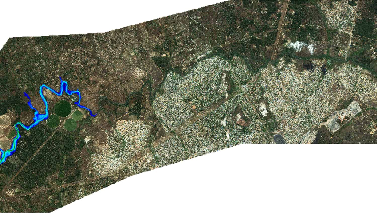
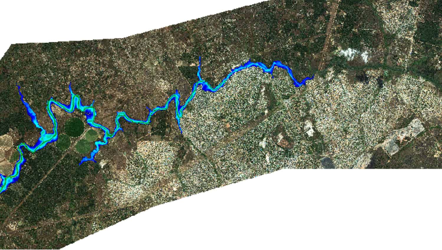
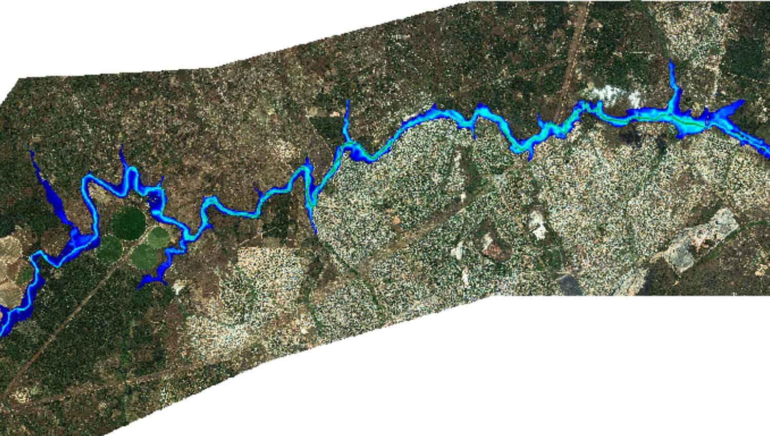
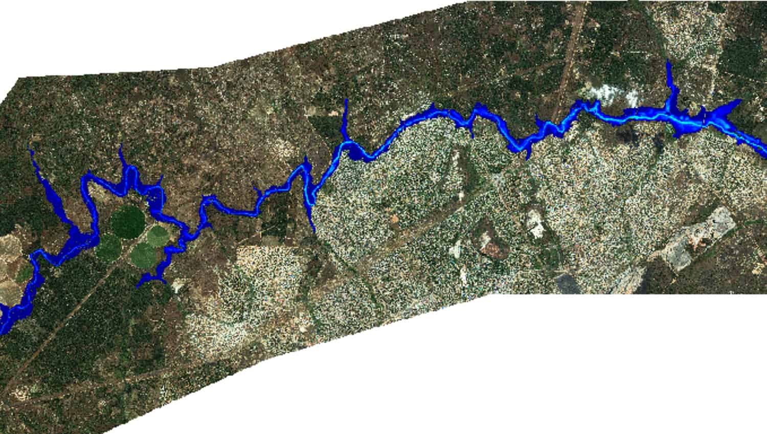
Many inundation areas cover hundreds of square kilometers and extend tens or hundreds of kilometers downstream of a tailings dam. For engineers, obtaining high quality inundation area topography can delay a tailings dam breach analysis (DBA).
PhotoSat’s Topography for Dam Breach Analysis (DBA) gives engineering consultants the hydro-corrected survey data required for conducting a dam breach analysis, without the need for site access.
The Topography for Dam Breach Analysis (DBA) package includes these standard deliverables.
Standard DeliverablesOptional Deliverables
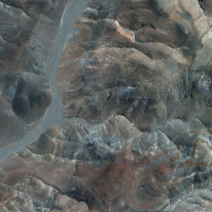
Precision Orthophoto
High-resolution orthorectified photo of your project area.
Resolution: as per satellite File format(s): ERS, JPEG, KML, LAS, PDF, PNG, TIF, and XML
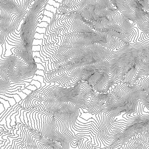
Contours
Available in 50 cm, 1 m, 5 m, 10 m, or custom intervals.
File format(s): DWG, DXF, KML, and SHP
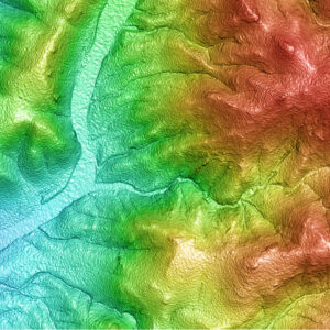
Colour Shade
Detailed 3D topography of your area with high elevations in warm colours and low elevations in cool colours.
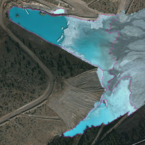
Water Body Outlines
Digital and geolocated linework of surface water including supernatant ponds, engineered tailings cells, naturally occurring water bodies, and/or seasonal accumulation.
Line: 1 pixel For water bodies 400 m2 or larger
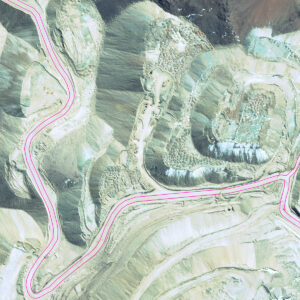
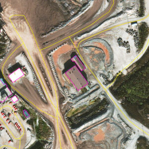
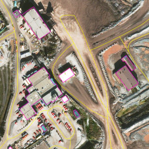
Road Edges
Digital and geolocated linework for road shoulders within your site.
Line: 1 pixel
Road Centerlines
Digital and geolocated linework for road centerlines within your site.
Line: 1 pixel
Buildings Outlines
Digital and geolocated linework of your site’s infrastructure, including buildings and engineered structures.
Line: 1 pixel
Comparison Study
How does topographic accuracy and resolution impact a dam breach simulation?