Effectively and efficiently managing major infrastructure projects comes with a host of challenges. For engineers, it is crucial to obtain engineering-grade survey data that covers the entire project area, without interfering with ground activity.
PhotoSat’s Development Surveying gives engineers accurate and site-wide data, so projects can continue as planned.
The Development Surveying package includes these standard deliverables.
Standard DeliverablesOptional Deliverables
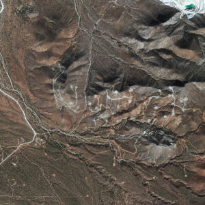
Precision Orthophoto
High-resolution orthorectified photo of your project area.
Resolution: as per satellite File format(s): ERS, JPEG, KML, LAS, PDF, PNG, TIF, and XML
Contours
Available in 50 cm, 1 m, 5 m, 10 m, or custom intervals.
File format(s): DWG, DXF, KML, and SHP
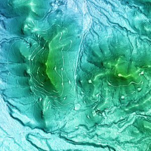
Colour Shade
Detailed 3D topography of your area with high elevations in warm colours and low elevations in cool colours.
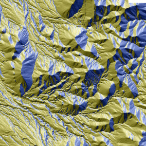
Slope Direction Image
East aspects in blue, west aspects in gold. North aspects appear bright, and south aspects appear dark.
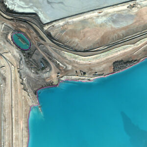
Water Body Outlines
Digital and geolocated linework of surface water including supernatant ponds, engineered tailings cells, naturally occurring water bodies, and/or seasonal accumulation.
Line: 1 pixel
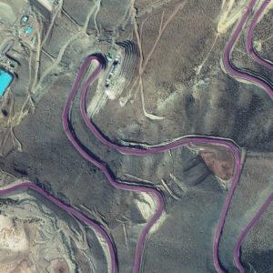
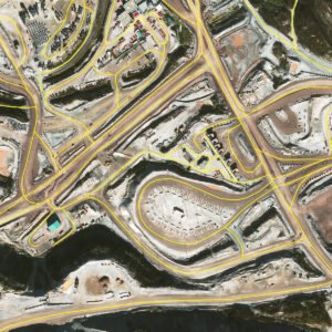
Road Edges
Digital and geolocated linework for centerlines and/or shoulders of roads within your site.
Line: 1 pixel
Road Centerlines
Digital and geolocated linework for road centerlines within your site.
Line: 1 pixel
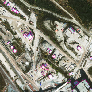
Buildings Outlines
Digital and geolocated linework of your site’s infrastructure, including buildings and engineered features.
Line: 1 pixel
Case History
How can satellite elevation surveys be used to verify drill hole collar data?