Geospatial Data for Exploration & Geology

Exploration Surveying

User-ready data for resource development projects
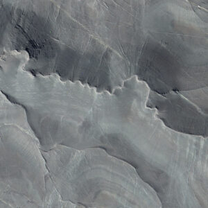
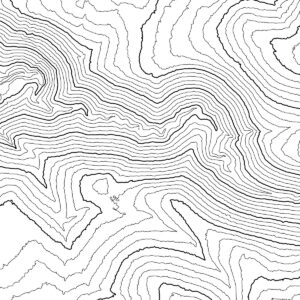
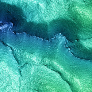
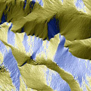
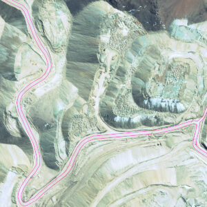
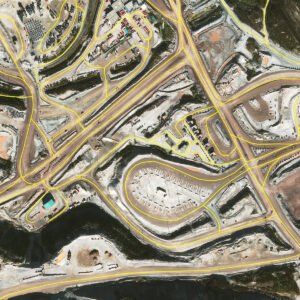
When areas of interest are large or difficult to access, getting accurate elevation survey data can delay the progress of new resource development projects.

PhotoSat’s Exploration Surveying ensures that each project starts on a foundation of engineering-grade survey data, without the need for ground control or a site visit.
Precision Orthophoto
Colour Shade
Precision Orthophoto
Colour Shade
Key applications:
  • Preliminary Economic Assessment
  • Pre-feasibility and Feasibility studies
  • Resource and reserve estimates
  • Drill hole collar verification
  • Project base mapping
Elevation grid formats:
File Format(s): ASCII, CSV, DWG, DXF, ECW, ERS, LAS, TIF, and XML.

Thinned Grid formats are available to reduce file size for projects over low-grade slopes.
Technical Specifications:
Type
Bare ground surface (DEM/DTM)
Vertical Accuracy (with control)
~10 – 30 cm RMSE More Info
Satellite Specifications for Elevation Surveys
Some specifications for survey deliverables depend on the satellite used to acquire the imagery.
Satellite Expected Vertical Accuracy Orthophoto Ground Resolution (Pixel Size) Orthophoto Colour Elevation Grid Spacing (Ground Sample Distance)
WV1 10 – 15 cm RMSE (with ground control) 50 cm Greyscale, with colourization options available 1 m or 50 cm
WV2 10 – 15 cm RMSE (with ground control) 50 cm Colour 1 m or 50 cm
WV3 10 – 15 cm RMSE (with ground control) 50 cm or 30 cm Colour 1 m, 50 cm, 30 cm, or 15 cm (resampled)
Pleiades 1A 20 – 30 cm RMSE (with ground control) 50 cm Colour 50 cm
Pleiades 1B 20 – 30 cm RMSE (with ground control) 50 cm Colour 50 cm
Keyhole -- 0.61 m to 1.2 m Greyscale 0.61 m to 1.2 m
Relative Accuracy
~20 cm over 5 km
Elevation Grid Resolution (GSD)
50 cm, 1 m, or custom
Vegetation Removal
Yes
Available from Archive Imagery
Yes
Satellites Source(s)
WV1, WV1 (colourized), WV2, WV3, Pleiades 1A/1B
Area of Interest
Custom
Coordinate System
Any, including custom mine grids

Deliverables

The Exploration Surveying package includes these standard deliverables.
Standard Deliverables Optional Deliverables

Case History

How can survey data become part of multiple stages of the project lifecycle?
Our technical team is ready to work with you.

Get a Quote