Interpretation-ready data for property-scale exploration programs
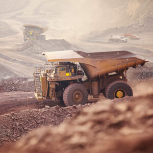
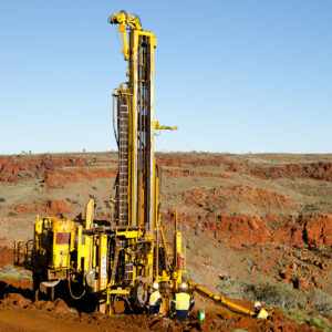
For property-scale exploration, areas of interest can cover hundreds of square kilometers. When these properties are large or inaccessible, geologists may have limited surficial data to support exploration programming.
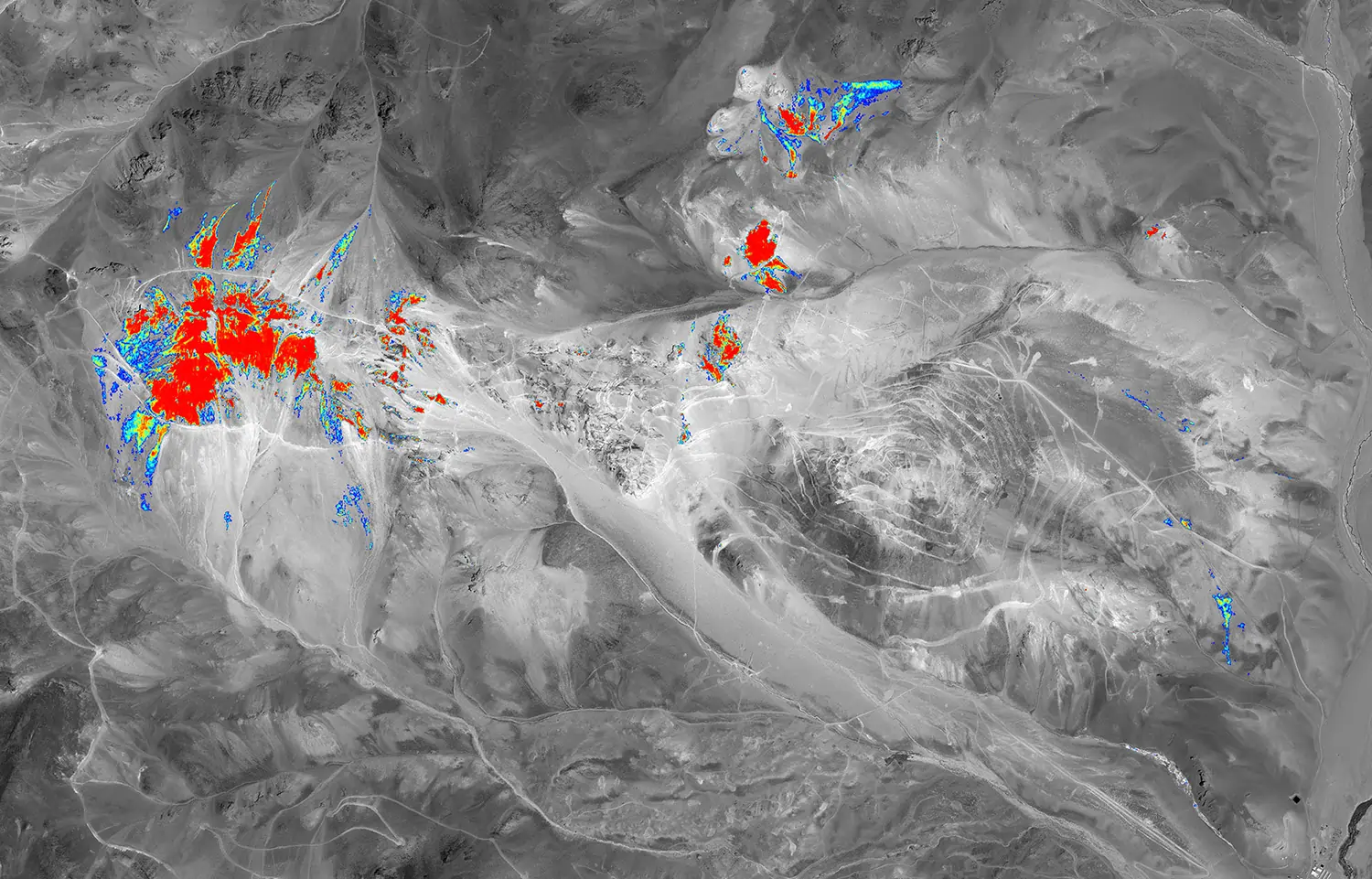
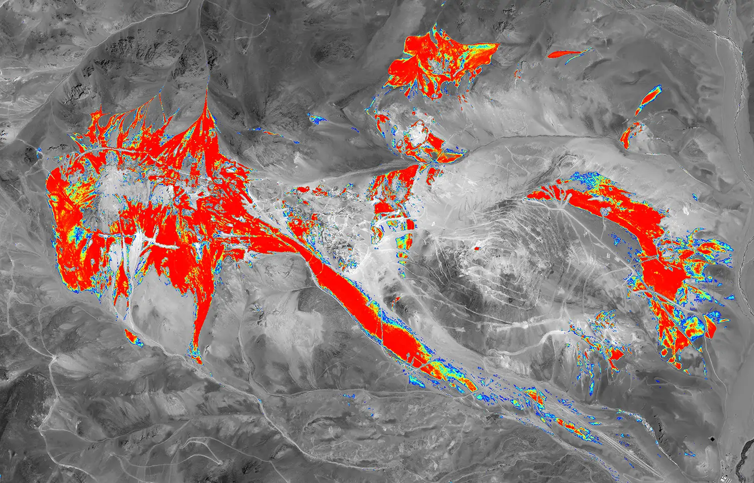
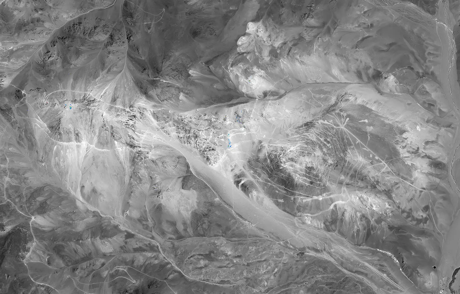
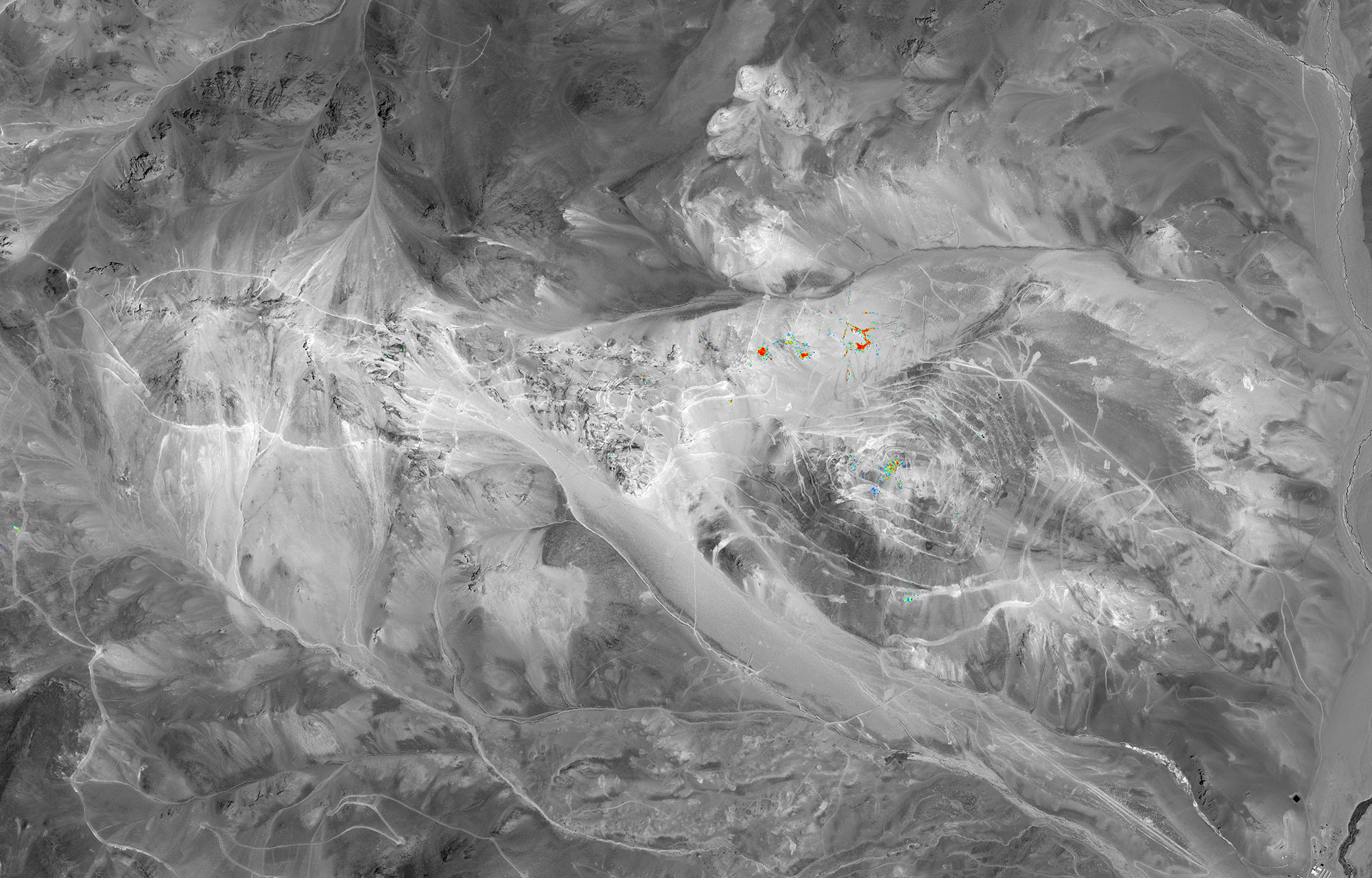
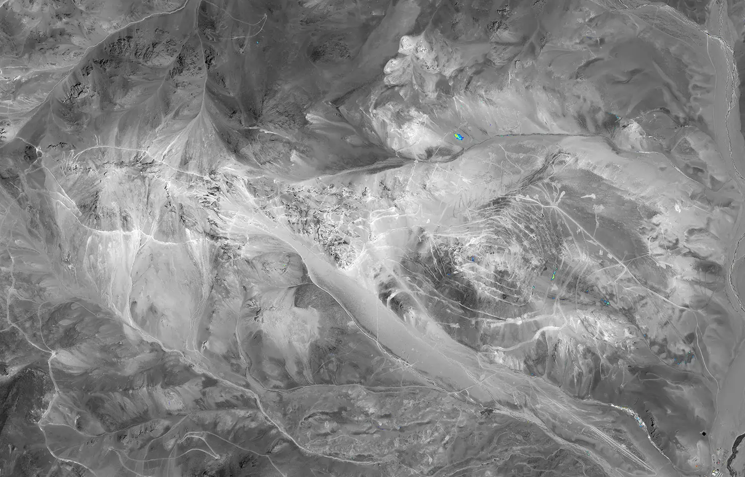
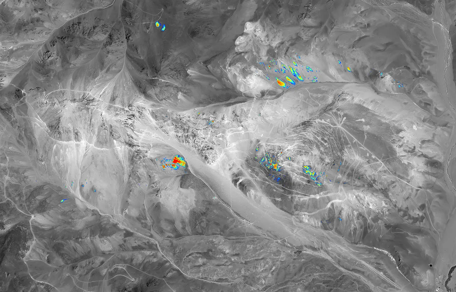
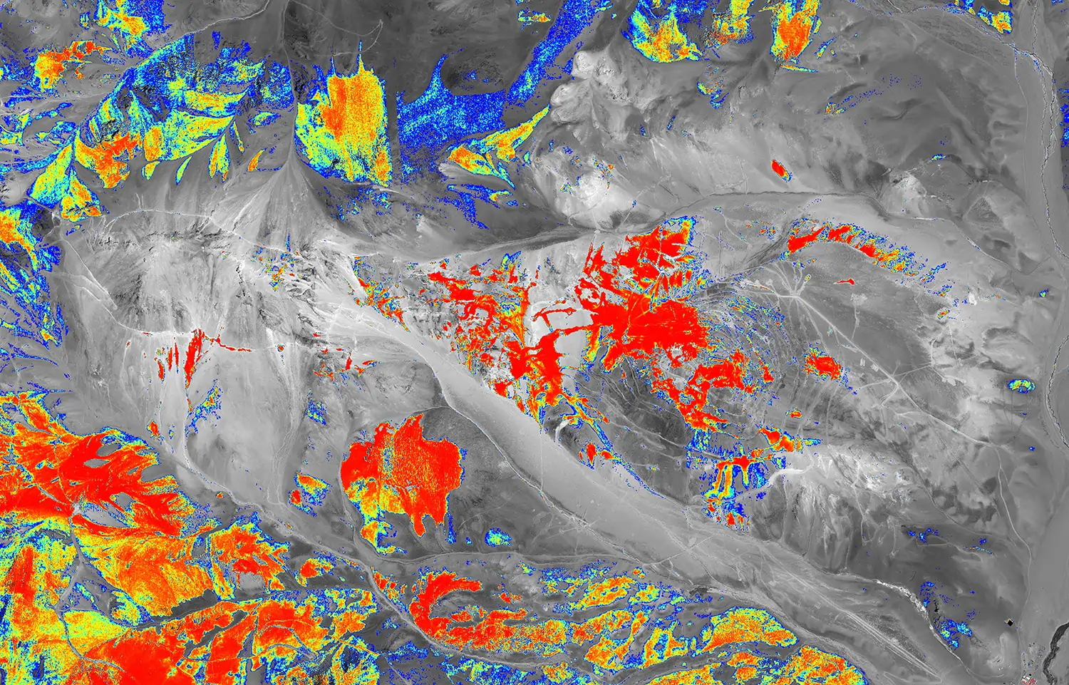
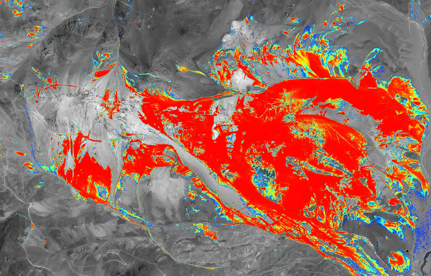
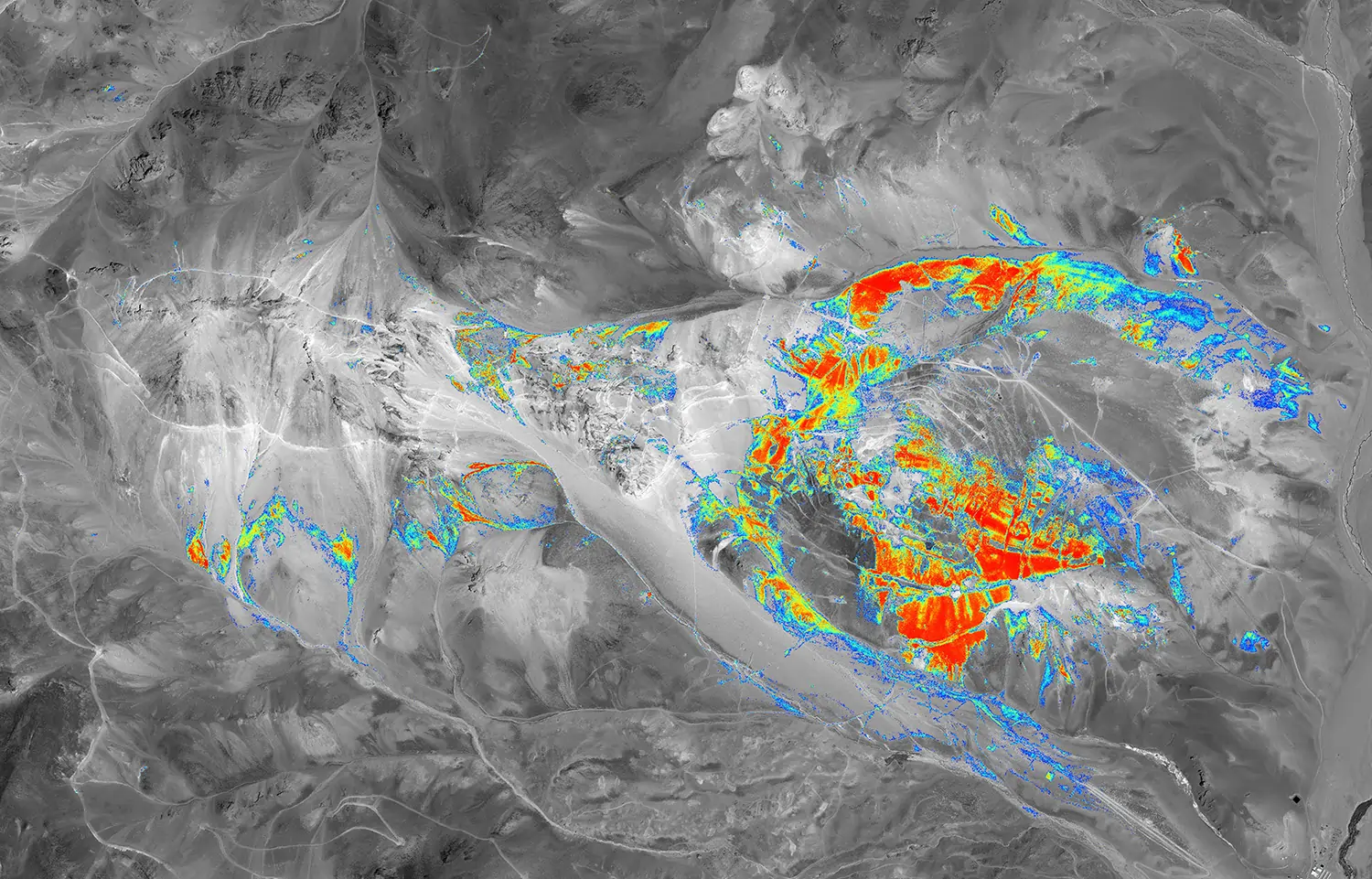
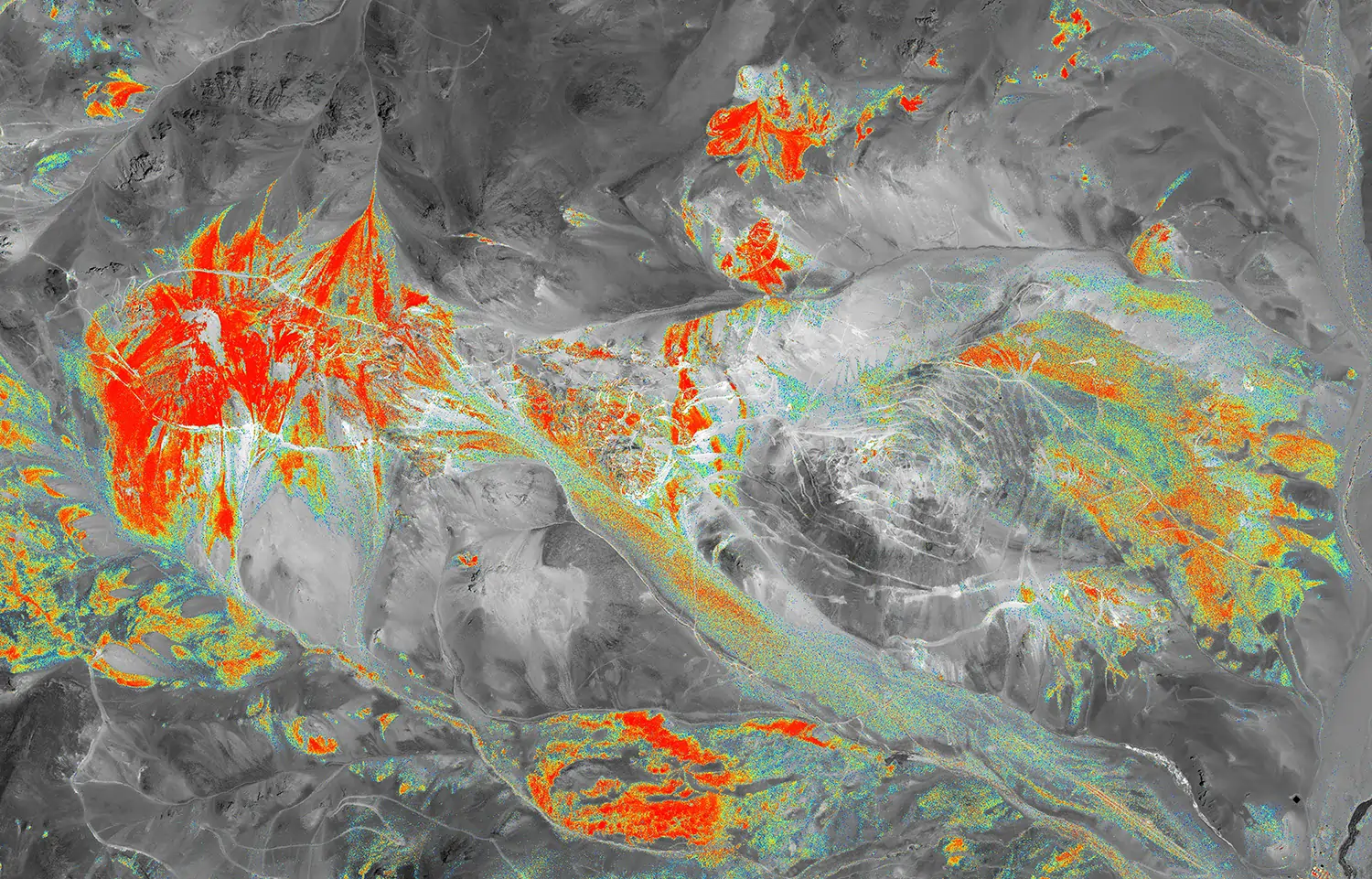
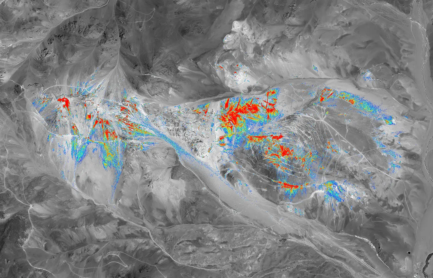
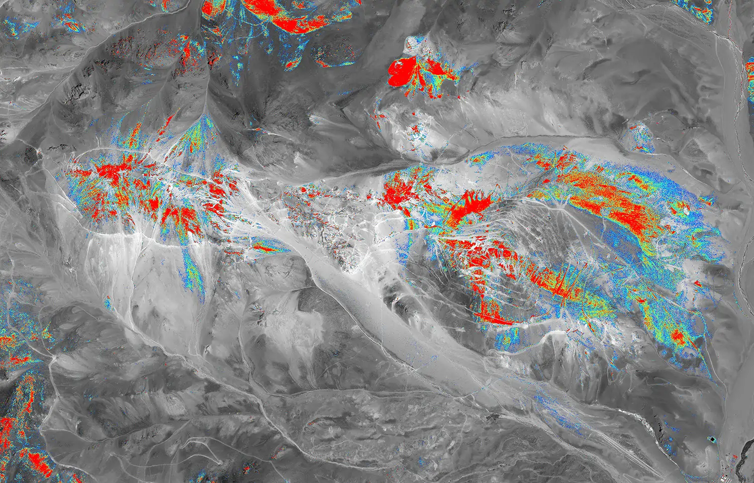
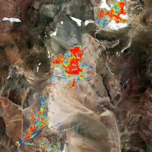
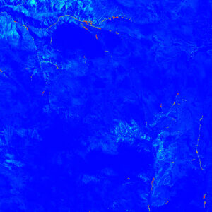
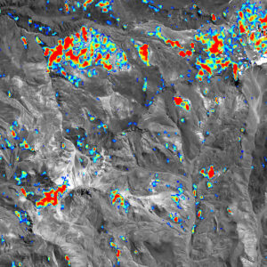
With PhotoSat’s Property Scale Alteration Mapping package, geologists get highly detailed mapping of alteration minerals to help select the best drill targets for advanced exploration, without the need for ground access.
Some specifications for alteration deliverables depend on the satellite used to acquire the imagery.
Spatial Resolution
Alteration Images (pixel size)
Context Images (pixel size)
WV3
Panchromatic (50 cm), VNIR (1.2 m), SWIR (3.7 m)
Alunite (2 m)
Kaolinite (2 m)
Buddingtonite (2 m)
Opal/chalcedony (2 m)
Calcite (2 m)
Chlorite/epidote (2 m)
Sericite (2 m)
Montmorillonite (2 m)
Goethite (2 m)
Hematite (2 m)
Jarosite (2 m)
Iron oxide gossans (2 m)
Geology enhanced image (2 m)
Colour orthophoto (50 cm)
Greyscale orthophoto (50 cm)
Vegetation index (2 m)
ASTER
VNIR (15 m)
SWIR (30 m)
TIR (90 m)
Alunite (12.5 m)
Kaolinite (12.5 m)
Buddingtonite (12.5 m)
Calcite (12.5 m)
Chlorite/epidote (12.5 m)
Sericite (12.5 m)
Iron oxide gossans (12.5 m)
Silica (75 m)
Geology enhanced image (12.5 m)
Greyscale orthophoto (12.5 m)
Vegetation index (12.5 m)
The Property Scale Alteration Mapping package includes these standard deliverables.
Standard DeliverablesOptional Deliverables
Alteration GeoTIFF
One interpretation-ready RGB alteration image for each mineral showing the 2D distribution from possible to probable and one customization-ready alteration image with the added ability to easily change colour tables and conduct additional analysis.
Resolution: 2 m pixel File format(s): GeoTIFF
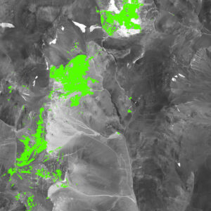
Alteration Shapefile
One 2D alteration vector file showing the distribution of each mineral and a second 2D alteration vector file showing the distribution of only the strongest alteration.
Resolution: 2 m pixel File format(s): Shapefile
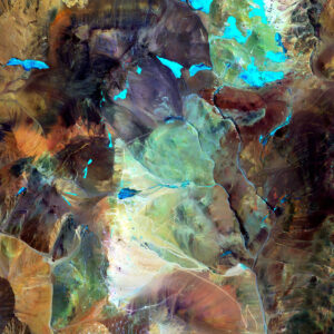
Geology Enhanced Image
A combination of two VNIR bands and one SWIR band to accentuate ground surface details that are not visible in a regular orthophoto.
Resolution: 2 m pixel File format(s): GeoTIFF
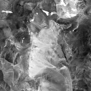
Greyscale Orthophoto
High-resolution orthorectified image of your project area, in greyscale.
Resolution: 50 cm pixel File format(s): GeoTIFF
Colour Orthophoto
High-resolution orthorectified image of your project area, in natural colour.
Resolution: 50 cm pixel File format(s): GeoTIFF
Vegetation Index
Density of vegetation throughout the project area.
Resolution: 2 m pixel File format(s): GeoTIFF
ASTER Silica
Alteration Shapefile and GeoTIFF images for silica.
Geology Enhanced Image
A combination of two VNIR bands and one SWIR band to accentuate ground surface details that are not visible in a regular orthophoto. More Details
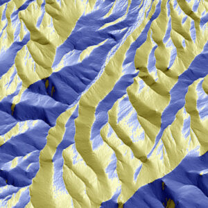
Satellite Specifications for Elevation Maps
Some specifications for map deliverables depend on the satellite used to acquire the imagery.
Satellite
Orthophoto Ground Resolution (Pixel Size)
Orthophoto Colour
Elevation Grid Spacing (Ground Sample Distance)
SPOT 6
1.5 m
Colour
3 m
SPOT 7
2 m
Colour
3 m
IKONOS
4 m
Colour
3 m
GeoEye
0.5 m
Colour
n/a
Available file formats: GeoTIFF
Colour Orthophoto
(note: use for WV3 only, not ASTER)
High-resolution orthorectified image of your project area, in colour. More Details
Satellite Specifications for Elevation Maps
Some specifications for map deliverables depend on the satellite used to acquire the imagery.
Satellite
Orthophoto Ground Resolution (Pixel Size)
Orthophoto Colour
Elevation Grid Spacing (Ground Sample Distance)
SPOT 6
1.5 m
Colour
3 m
SPOT 7
2 m
Colour
3 m
IKONOS
4 m
Colour
3 m
GeoEye
0.5 m
Colour
n/a
Available file formats: GeoTIFF
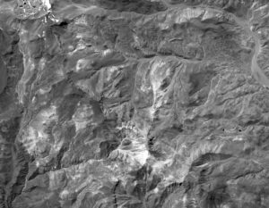
Greyscale Orthophoto
High-resolution orthorectified image of your project area, greyscale. More Details
Satellite Specifications for Elevation Maps
Some specifications for map deliverables depend on the satellite used to acquire the imagery.
Satellite
Orthophoto Ground Resolution (Pixel Size)
Orthophoto Colour
Elevation Grid Spacing (Ground Sample Distance)
SPOT 6
1.5 m
Colour
3 m
SPOT 7
2 m
Colour
3 m
IKONOS
4 m
Colour
3 m
GeoEye
0.5 m
Colour
n/a
Available file formats: GeoTIFF
Vegetation Index
Density of vegetation throughout the project area. More Details
Satellite Specifications for Elevation Maps
Some specifications for map deliverables depend on the satellite used to acquire the imagery.
Satellite
Orthophoto Ground Resolution (Pixel Size)
Orthophoto Colour
Elevation Grid Spacing (Ground Sample Distance)
SPOT 6
1.5 m
Colour
3 m
SPOT 7
2 m
Colour
3 m
IKONOS
4 m
Colour
3 m
GeoEye
0.5 m
Colour
n/a
Available file formats: GeoTIFF
Isopach Maps
Time-stamped distance and volume measurements for tailings facilities, leach pads, stockpiles, waste dumps, and more.
Elevation Profiles
Time-stamped cross-sections of tailings embankments, tailings beaches, leach pads, stockpiles, and more.
Change Visualization
Extent and direction of change (in x,y,z) for the ground surface between successive surveys.
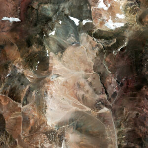
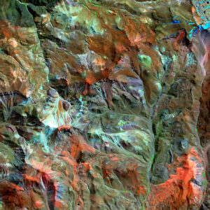
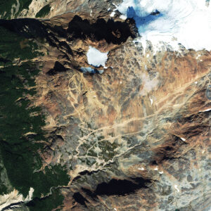
Filo del Sol with WV3
How can high-resolution alteration mapping from WorldView-3 support exploration programming at property scale?