A tailings deposition plan is only as good as the data behind it.
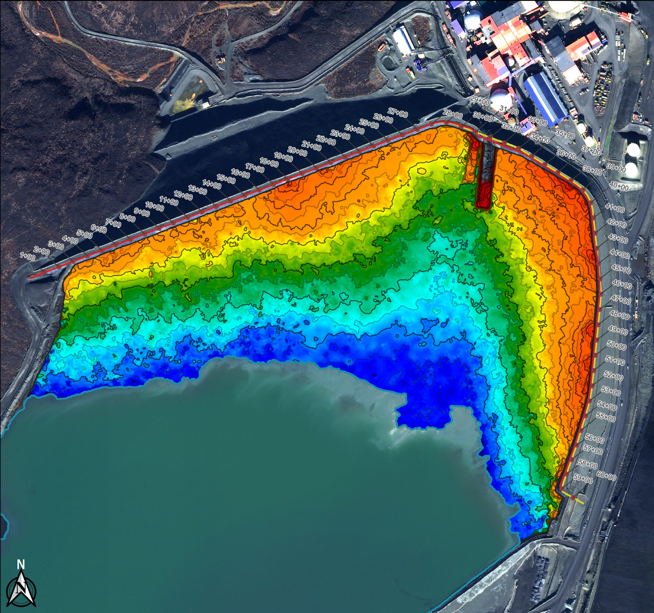
At Teck Alaska Inc., Red Dog Operations, high-resolution satellite surveys, drone photogrammetry, bathymetric surveys, and RTK GPS measurements are integrated into a single Base Surface that supports deposition modelling, density reconciliation, beach length monitoring, storage capacity assessments, and long-term planning. Embedded within Red Dog’s Plan-Do-Check-Act (PDCA) process, this integrated survey approach helps the team evaluate performance, refine deposition strategies, and make informed operational decisions.
Co-authored by Teck Red Dog and PhotoSat, and presented at Tailings and Mine Waste 2025, this case study illustrates how combining complementary survey technologies can improve tailings deposition management.