Discover what others missed with the next generation of satellite alteration mineral mapping
In regional exploration, areas of interest can stretch over thousands of square kilometers. Because these areas are usually large or inaccessible, gathering surficial data can be time consuming and difficult. But without geological data, geologists face major challenges in planning large-scale exploration programs.
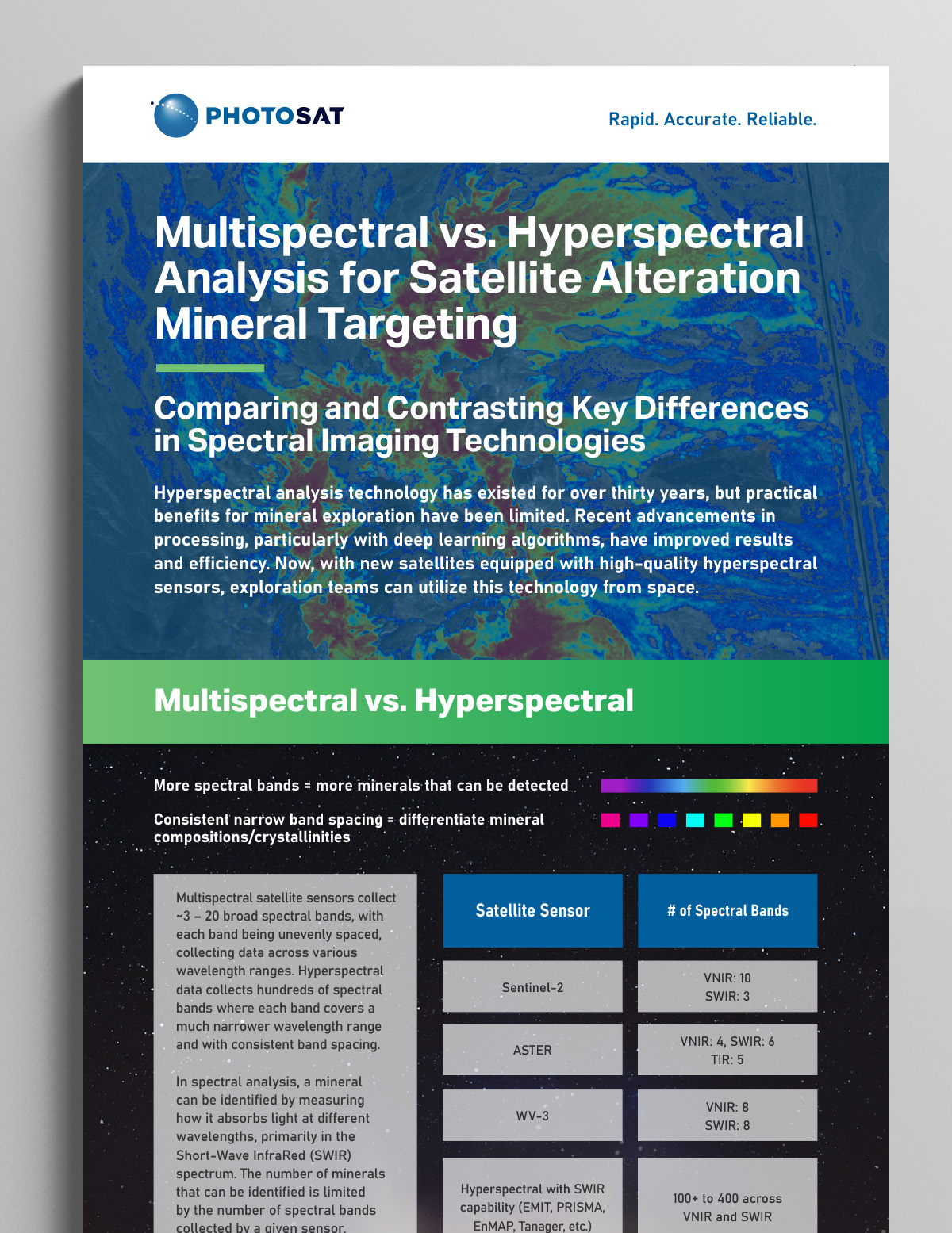
Regional Hyperspectral Exploration Targeting (R-HET) utilizes the next generation of hyperspectral satellite technologies to detect more alteration minerals with greater accuracy, supporting data-driven mineral exploration. With more than 20 alteration minerals identified, differentiation between mineral compositions and crystallinities, and estimated relative mineral abundances, R-HET is the ideal solution for exploration managers searching for viable claims and project target generation. This data provides the essential information and visuals required to construct a compelling business case, effectively demonstrating a site’s exploration potential to you, your team, and your key stakeholders.
Core Deliverables
Our standard deliverables include alteration images, vectors, and context imagery such as geology-enhanced images, colour images, greyscale images, vegetation indices and false colour composite images.
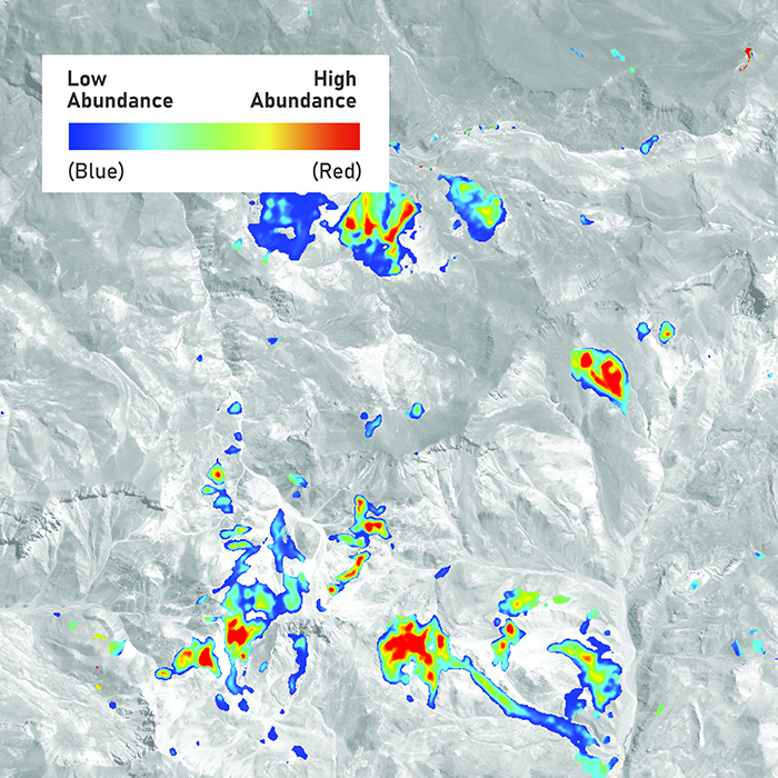
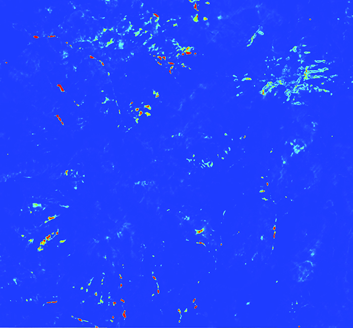
Alteration Images (GeoTIFF)
RGB alteration image per mineral (2D distribution from possible to probable) and a customizable single band image for colour changes and further analysis.
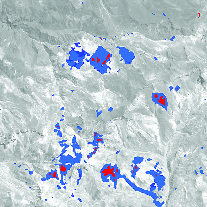
Alteration Vectors (Shapefile)
Two 2D alteration vector files will be provided, one for each mineral distribution and another for strongest alteration responses. These files facilitate the creation of mineral compilation maps to visualize alteration mineral assemblages.
Other Deliverables
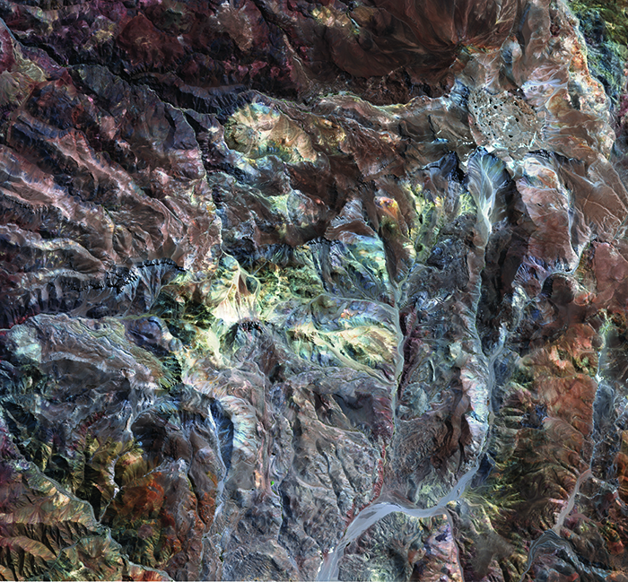
Colour Image
Orthorectified image of your region or project area, in colour.
Pixel size: 10 m
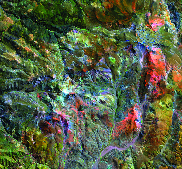
Geology Enhanced Image
VNIR and SWIR bands accentuate additional surface details that are not visible in a regular orthophoto.
Pixel size: 10 m
Greyscale Image
Orthorectified image of your region or project area, in greyscale.
Pixel size: 10 m
Vegetation Index
Orthorectified image of your region or project area displaying vegetation.
Pixel size: 10 m
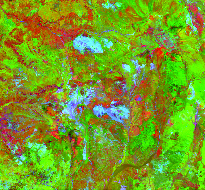
Sabins Composite
A combination of spectral indices shown as RGB, which highlights changes in primary lithologies and alteration, especially ferric oxides.
Pixel size: 10 m
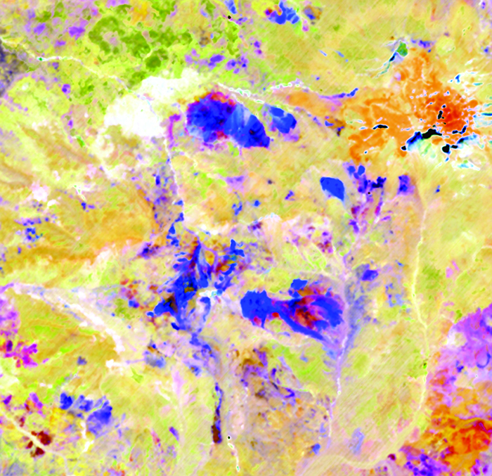
Sultan Composite
A combination of spectral indices is shown as RGB, which highlights changes in primary lithologies and alteration, especially clay minerals.
Pixel size: 10 m
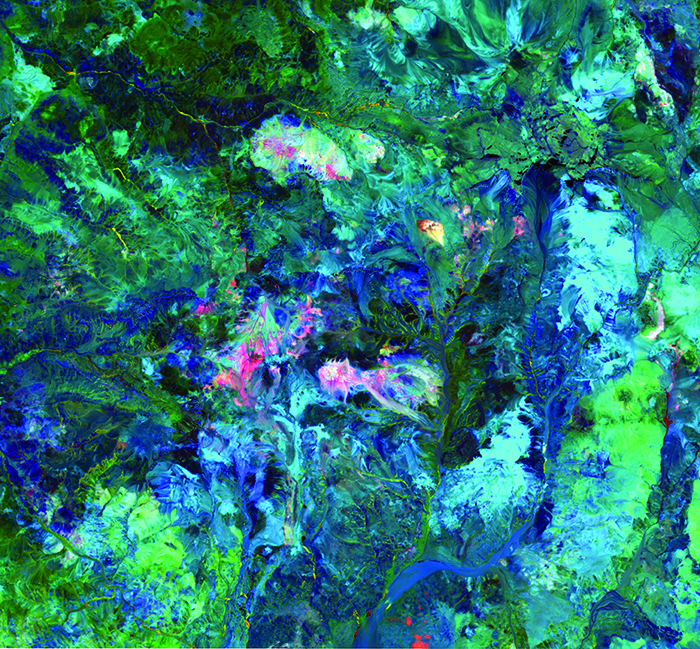
SWIR-Enhanced Image
Shows subtle mineral or compositional changes in clays, white micas, and carbonates not visible in other images.
Pixel size: 25 m
Highlights
Detect 20+ alteration minerals over 1000s to 10,000s of km2.
Deep-learning models detect subtle subpixel alteration mineral responses in heavily mixed spectra, leading to more complete and accurate results.
Processing time of approximately 2 to 3 weeks.
Identifiable Minerals, Compositions, and Relative Abundances:
Mineral
Resolution
Opal / Chalcedony
25 m
Alunite Abundance
25 m
K-Alunite
25 m
Na-Alunite
25 m
Kaolinite
25 m
Dickite
25 m
Pyrophyllite
25 m
Muscovite Abundance
25 m
High Al Muscovite
25 m
Low Al Muscovite
25 m
Illite
25 m
Montmorillonite
25 m
Mineral
Resolution
Buddingtonite
25 m
Calcite
25 m
Chlorite/Epidote Abundance
25 m
Fe-Chlorite
25 m
Mg-Chlorite
25 m
Epidote
25 m
Goethite
25 m
Jarosite
25 m
Hematite
25 m
Iron Oxide Gossans
10 m
Silica
75 m
Detect over twice as many minerals as multispectral tools, reveal subtle compositional changes, and estimate mineral abundance with higher accuracy and fewer false positives.
Info Sheet
Get started with R-HET to achieve results that are not possible with traditional data processing methods alone.