Improve Tailings Monitoring with Better Topography Get The Resource Kit Today
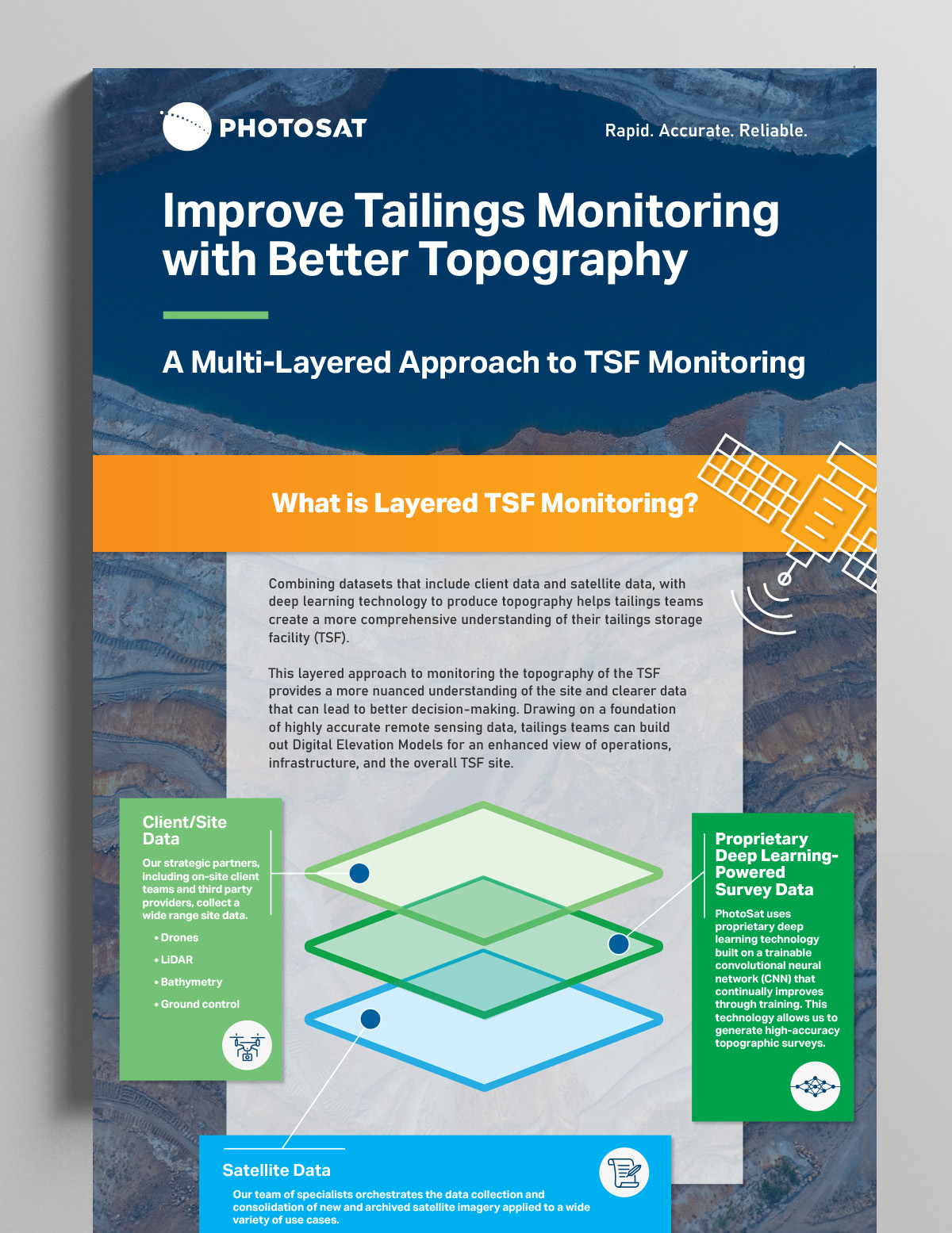
A Multi-Layered Approach to TSF Monitoring
Embracing proven technologies like deep learning-powered topographic survey data and insights from satellite imagery can augment and enhance oversight with added precision.
These advanced monitoring technologies equip mine site operators with valuable decision-making insights.
White Paper
A guide to alteration mineral mapping, contrasting established multispectral methods with next-gen hyperspectral mapping.